The Iron Age (1200-600 BC)
In the early Iron Age Karkemish was the capital of a local Hittite dynasty, which controlled a stretch of the Euphrates southwards, probably including Aushariye. Other forces, however, were at work. From west and south appeared mobile Aramean groups and settled in the region, and simultaneously the Assyrians, from their base in northern Iraq started to expand their domain. Tiglathpileser I (1114-1076 BC), according to information by his later successor Shalmaneser III (858-824 BC), occupied Pitru on the west bank of the Euphrates, but this place was lost to Arameans ca. 100 years later, and was recaptured by Shalmaneser in the mid-9th cent. BC. Subsequently the Assyrians largely controlled the Euphrates region until the fall of their empire in the late 7th cent.
In Aushariye parts of three Iron Age levels have been excavated. The upper, younger Level I is badly damaged by erosion and later pits, but dates to the later part of the Iron Age (8th-7th cent. BC), when the region had become firmly integrated in the Assyrian empire. Towards the end of this period Aushariye was apparently no longer needed as a fortress, and the many pits with Late Assyrian material would indicate that the site ended as a kind of village. This situation is seen also on other Iron Age sites on the Euphrates. The region was no longer a border zone, but virtually part of the Assyrian home land.
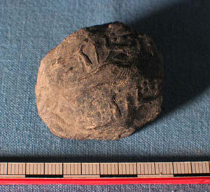
Clay cork sealed with Assyrian cylinder seal, from pit in Area P.
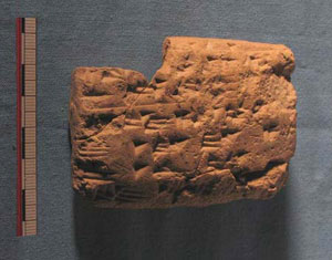
Assyrian cuneiform tablet with administrative text. From pit in Area B.
A good example of the merging local and Assyrian culture in this period is a unique find from a pit in Area B. A fragment of a large stone tablet, of format like a large clay tablet, but inscribed with an inked draft of a text in Aramean letters, no doubt a very important document. The first lines in the first column (upper left) are incised on top of the ink. Then perhaps the stone broke and was discarded – since the rest of the text remained only in ink draft. Unfortunately only isolated bits of the inscription is legible, but the character of the script dates it to the 8th cent. BC.
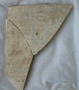
Fragment of Aramean stone tablet.
The two older Iron Age levels are better preserved. In Area A on the high part of the plateau part of a major building, possibly the administrative center of the settlement, has been excavated. The building was founded in Level III, and was rebuilt in Level II.
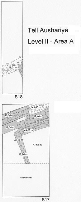
Plan of Area A, Level II. Larger image »
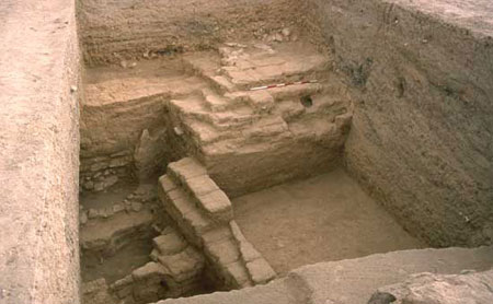
Area A, Level II.
On the lower and broader part of the plateau, in Area B, remains of houses divided by a small alley have been excavated. Also here it seems that Level II is a rebuilding of the older Level III, which has only been reached in small sondages.
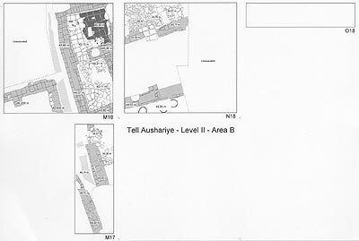
Plan of Area B, Level II. Larger image »
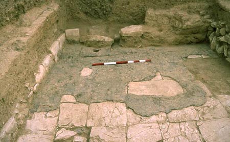
Bathroom in the east house in B, Level II.
Surrounding the plateau structures was a nearly 6 m wide enceinte, which has so far only been exposed in the narrow step trench Area O.
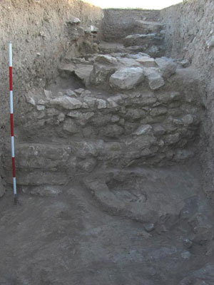
The enceinte of Level II, Area O.
Outside this enceinte was a terrace, placed on the foundations for the Middle Bronze Age (Level VII) terrace. Presumably the terrace ended with a second enceinte, of which some foundation remains have been found in Areas G and O. Between the two main enceintes were small rooms, only preserved on the upper part of the terrace.
The excavations of Level II and III contexts have yielded large amounts of potsherds and other finds, but no firm clues for precise dating of the two levels. The ceramics point to a date of Level III in the earlier part of the Iron Age (11th-10th cent. BC), and Level II in the 9th-8th cent. BC.
If Aushariye is identical with ancient Pitru one may expect to find some traces of the earlier Assyrian occupations, but so far Levels III-II have produced no explicit evidence.
