
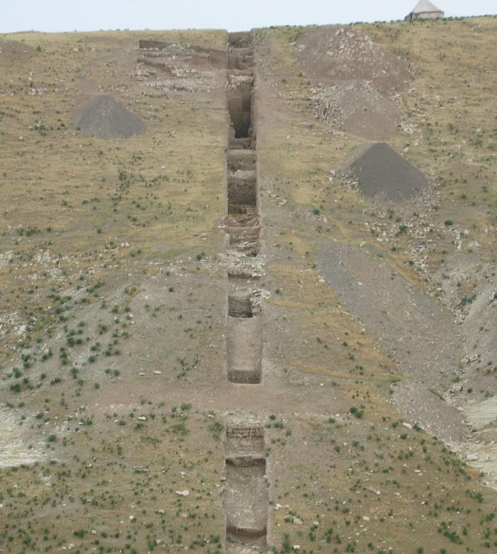
The 100-meter steptrench in Area O
In 2002 we initiated a 100 m long steptrench down the south slope of Aushariye. The purpose was to investigate remains of the ancient fortifications, partly visible on surface. Initially it was estimated that cultural deposits were shallow, and that excavation would soon reach bedrock. Relatively quickly, however, it became clear that preservation was much better, and the operation has therefore continued the following seasons. Although some sections of the trench require further investigation, the operation is substantially completed, and we can present a section through the slope with deposits of different periods in the history of the site.
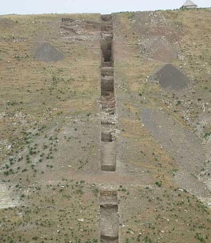
The 100 meter trench viewed from south, April 2005.
Larger image »
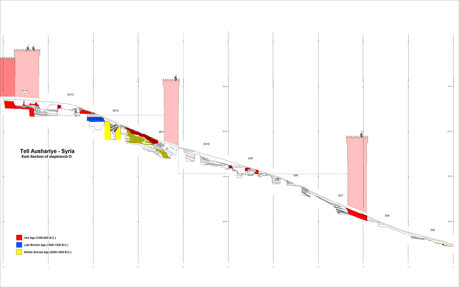
The trench is 2 m wide, and the drawing shows the eastern profile. The attempted reconstruction of the Iron Age fortifications is of course tentative only.
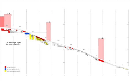
Profile drawing of the 100-meter steptrench
Larger image »
or CLICK on the periods represented underneath for information about the periods:
 |
Iron Age (1200-600 BC) |
 |
Late Bronze Age (1600-1200 BC) |
 |
Middle Bronze Age (2000-1600 BC) |